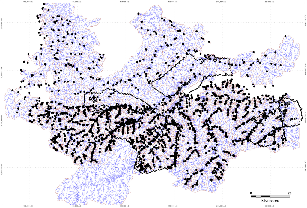
More than 6,700 line-kilometers of high-resolution magnetic and radiometric data across the Mölltal Fault corridor will provide the structural framework for the Company’s next round of target generation.
VIENNA, Austria – September 2, 2026 – Ekometall Inc. (“Ekometall” or the “Company”), through its wholly owned subsidiary, Ekometall Exploration GmbH, today announced that it has contracted a high-resolution airborne magnetic and radiometric survey over its Grossfragant license area in Carinthia, Austria. Data collection is scheduled to begin around September 14, 2026. The resulting data will be integrated with the Company’s archival, geological and geochemical datasets to define and rank targets across the 1,200 km² license area.
The heliborne survey, to be flown by terratec Geophysical Services GmbH & Co. KG, will be, to the Company’s knowledge, the first modern airborne geophysical survey of the southeastern Tauern Window in over four decades.
Highlights
- The survey will cover approximately 1,200 km² over more than 6,700 line-kilometers at 200-meter line spacing and a nominal terrain clearance of 60 meters, acquiring total-field magnetic and full-spectrum radiometric data;
- Data collection is scheduled to begin on September 14, 2026, and to take approximately four to six weeks, subject to weather and aviation clearances;
- The survey is designed to map the structural framework of the Mölltal Fault, domain contacts, shear zones and fold closures, together with the magnetic response of prospective host rocks and the potassium and thorium alteration signatures associated with gold mineralization, providing the anchor for subsequent ground exploration and target generation;
- Grossfragant straddles the regional Mölltal Fault, spanning the Penninic Tauern Window and the Austroalpine Kreuzeck-Goldeck domain;
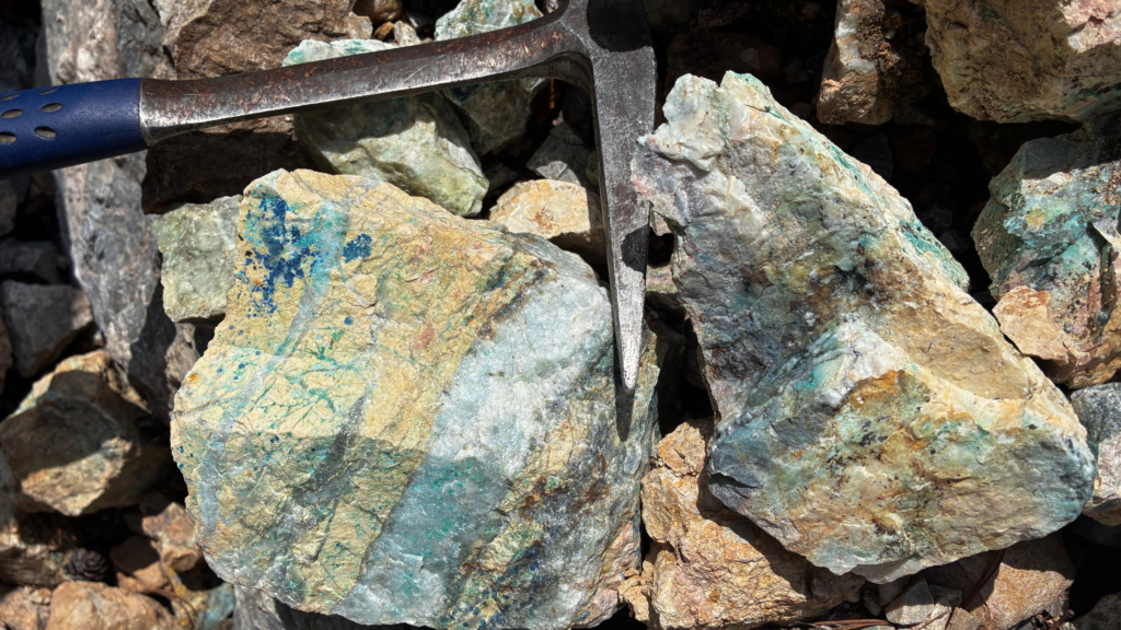
- The 1,200 km² license area is prospective for several deposit models, including orogenic gold, metamorphosed VMS, stratabound sulfide / SEDEX, among others, with exposure to several EU Critical Raw Materials including copper, cobalt, antimony, and tungsten;
- Processing and interpretation will be led by GexplOre and will include data QA/QC, processed magnetic and radiometric grids, 3D magnetic inversion modelling and structural interpretation, integrated with the Company’s existing geological, archival and geochemical datasets and its AI-assisted target generation workflow;
- The survey will be flown by terratec Geophysical Services GmbH & Co. KG using an Airbus H125 helicopter in a nose-boom configuration, equipped with a Scintrex cesium magnetometer and a MEDUSA 256-channel cesium-iodide gamma-ray spectrometer.
“Grossfragant is where we put the whole process to work,” said Ryan Finlay, Managing Director and CEO of Ekometall. “We have the archives, we have the national geochemistry, and this survey adds the structural backbone the district has been missing. Together those layers take us from regional prospectivity to ranked ground targets, and they establish a workflow we can scale across the rest of our Austrian exploration licenses.”
About the Survey
The survey will acquire total-field magnetic and full-spectrum radiometric data at a nominal terrain clearance of 60 meters, delivering standard magnetic products (total magnetic intensity, reduced-to-pole, first vertical derivative and analytic signal) and radiometric channels for uranium, thorium, potassium and total count. All raw field, base-station, calibration and navigation data will be retained to support independent verification and reuse.
Processing and interpretation of the resulting datasets will be led by GexplOre, with a scope that covers:
- Manual quality assurance and control of the magnetic and spectrometric data;
- Production of processed magnetic and radiometric grids, including derived element contents and ratios;
- 3D magnetic inversion modelling;
- Structural interpretation of the datasets by a structural geologist;
- AI-assisted target generation integrating the geophysical results with the Company’s other datasets, and;
- Delivery of final maps, cross-sections and a summary report.
Flight operations are expected to take approximately four to six weeks, subject to weather and aviation clearances, with execution supported by proactive engagement with local municipalities and low-impact operating practices.
Preliminary processed magnetic and radiometric grids are expected within Q4 2026 of the completion of flying, with the final structural interpretation, ranked target inventory and summary report expected in Q1 2027. The Company intends to report material results as they become available.

About terratec Geophysical Services GmbH & Co. KG
Founded in 1989 and headquartered in Heitersheim, Germany, terratec Geophysical Services GmbH & Co. KG provides airborne, surface and borehole geophysical services for mineral exploration, groundwater and geothermal prospecting, and geotechnical investigation. The company operates its own EASA-certified helicopter nose-boom magnetic and radiometric system and maintains offices and logistics bases across Europe and Africa, including in Austria.
About GexplOre
Founded in 2012, GexplOre is a French geosciences company specializing in mineral exploration services across Europe, Africa and the Americas. The company delivers geological, geophysical, borehole logging and data science support from early-stage exploration through to advanced project development, combining field capability, technical interpretation, project management and digital workflows for the structuring, analysis and use of complex geoscientific data. Working in line with international standards including JORC, NI 43-101 and PERC, GexplOre helps exploration and mining clients build robust geological understanding and accelerate technical decision-making.
About Ekometall
Ekometall is an emerging critical minerals exploration company focused on unlocking Austria’s significant precious and base metal potential across the country’s historic mining districts. The Company has assembled a specialized, Austria-based technical team that applies AI-assisted analysis to digitize and interpret over five centuries of previously inaccessible geological records, transforming archival data into actionable exploration targets.
With a dominant first-mover land position exceeding 10,000 km² and a demonstrated ability to efficiently permit and execute drilling programs, Ekometall offers global mining partners a compelling entry point into a favorable European jurisdiction. The Company’s combination of local expertise, modern exploration methods, and extensive mineral tenure establishes Ekometall as the essential gateway for accessing the critical raw materials vital to Europe’s energy transition and industrial future.
For more information, visit ekometallgroup.com.
For more information on Ekometall’s projects or for investor relations inquiries, please contact:

Ryan Finlay
Managing Director & CEO