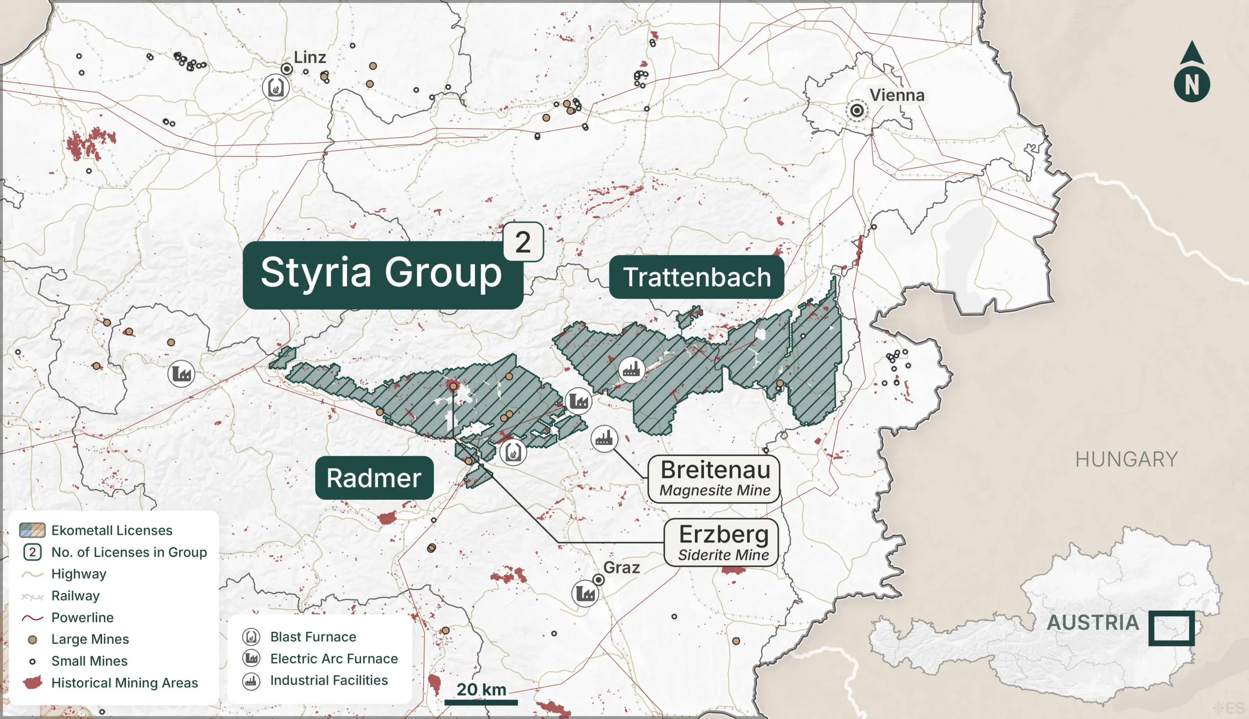
Austria’s Most Productive Metallogenic Belt — The Heart of the Eisenwurzen
~2,524 km²
Total License Area
2
License Blocks
target commodities
Overview
The Greywacke Zone — Austria’s Historic Mining Backbone
The Styria Group sits on the Greywacke Zone, the Paleozoic sedimentary and volcanic belt that runs continuously along the northern flank of the Eastern Alps through Styria and into Lower Austria. This is Austria’s most historically productive metallogenic belt, hosting iron, base metals, magnesite, and gold mineralization across centuries of systematic exploitation.
The two license blocks together capture a substantial strike length of this belt, from Radmer in the west through to the Mürzzuschlag/Lower Austria border in the east. The geology is characterized by alternating competent and incompetent units that have focused hydrothermal fluid flow and created repeated mineralization events over geological time. These are well-established systems that remain open at depth and along strike — precisely the type of targets that modern exploration techniques are designed to unlock.
Infrastructure
The Styria Group benefits from excellent infrastructure across both blocks. The Mürz and Mur valley corridors provide road and rail access throughout, with the Südbahn main line and A2/S6 motorway running through the Trattenbach–Mürzzuschlag area, and the Mur Valley railway serving the Radmer–Kalwang corridor. The regional centers of Leoben, Bruck an der Mur, and Mürzzuschlag provide industrial services, skilled labor, and logistics support. The proximity of Leoben — home to the Montanuniversität, one of Europe’s leading mining and metallurgy universities — is a particularly notable asset for technical expertise and potential research collaboration.
mining heritage
The Eisenwurzen —
Iron Roots of an Empire
The Styria Group sits at the heart of the Eisenwurzen — literally the "Iron Roots" of the Habsburg Empire — one of the longest continuously exploited mining regions in Central Europe. Radmer was a significant iron ore producer, with workings dating back to medieval times. The entire corridor from Radmer to Mürzzuschlag formed part of the industrial backbone that supplied the Habsburg ironworking and steelmaking industry centred on nearby Eisenerz and Donawitz. This group exhibits centuries of exploitation and points to well-established mineralized systems that remain open at depth and along strike.
What’s Next
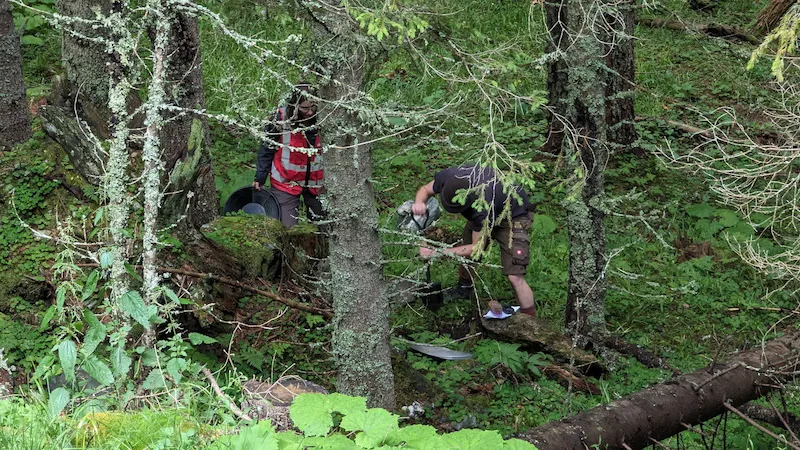
The Styria Group is currently in the Historical Data Aggregation and Scraping Phase I stage of the Ekometall Process. GexplOre is processing hundreds of geological reports from the Trattenbach and Radmer archives, building the structured dataset that will feed into target generation workflows. As multi-criteria analysis identifies priority prospects, this section will be updated with target summaries, planned field programs, and drill results.